Weeknote 02
Studying for IAAP CPACC
I'm currently studying for an IAAP certification using the Deque online course. I've not studied in this way for some years and was not great at it when I had a more robust memory to depend on. The type of learning in these courses is probably the worst type of pedagogy. IAAP simply provides an itemised syllabus, which you have to memorise before taking a 2 hour exam. Deque provides an online course including some interactive learning components, which are meagre attempts at making an engaged learning experience. Effectively, the online course is an expansion of the syllabus information with some images and videos. The content is, however, well written and I'm confident it is accurate. The missing element is (so far) any applied use of the knowledge and a learning community. That said, I'm guessing that the goal of these types of professional certifications is primarily to test knowledge rather than teach.
I'm currently at an unimpressive 21% through the course material. I feel if I write it here then I'm more accountable. 🤞
Co-creating a service map
Myself and a user researcher facilitated a session with some colleagues who have expertise in the infrastructure and backstage processes of Digital Archiving at The National Archives. The same staff also deal directly with users who transfer digital records to us. We successfully created a rough map of the user actions and touchpoints. As mentioned in a previous weeknote, the sense I got from this activity was that, no matter how wonderfully designed the eventual service blueprint, myself and other colleagues learnt a huge amount through the process of co-creating the map. One other discovery was the scale and variability of the unknown processes happening out of site of our service.
Alluvial maps
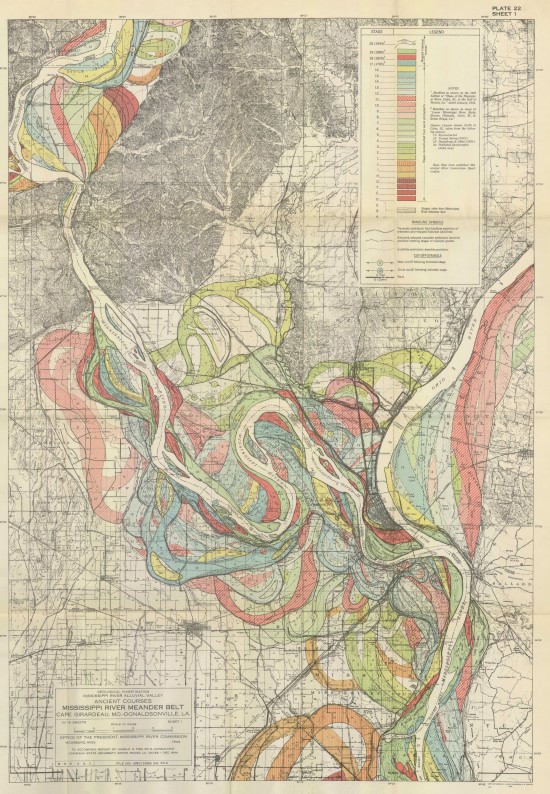
I found these beautiful maps of the Mississippi from a geologist commissioned by the Army Corp of Engineers on the Public Domain Review.

The highest resolution versions are no longer available on the Army Corp website but you can get mid-res (96 dpi) versions from here.
They are maps in the geographic sense but also a mapping of the temporal change of the rivers course across thousands of years. The area is called the Mississippi River Alluvial Plain - alluvium being the name of the material that is deposited by running water. By no coincidence the Alluvial diagram is a commonly form of data visualisation diagram (similar to a Sankey) that shows changes in a network over time.